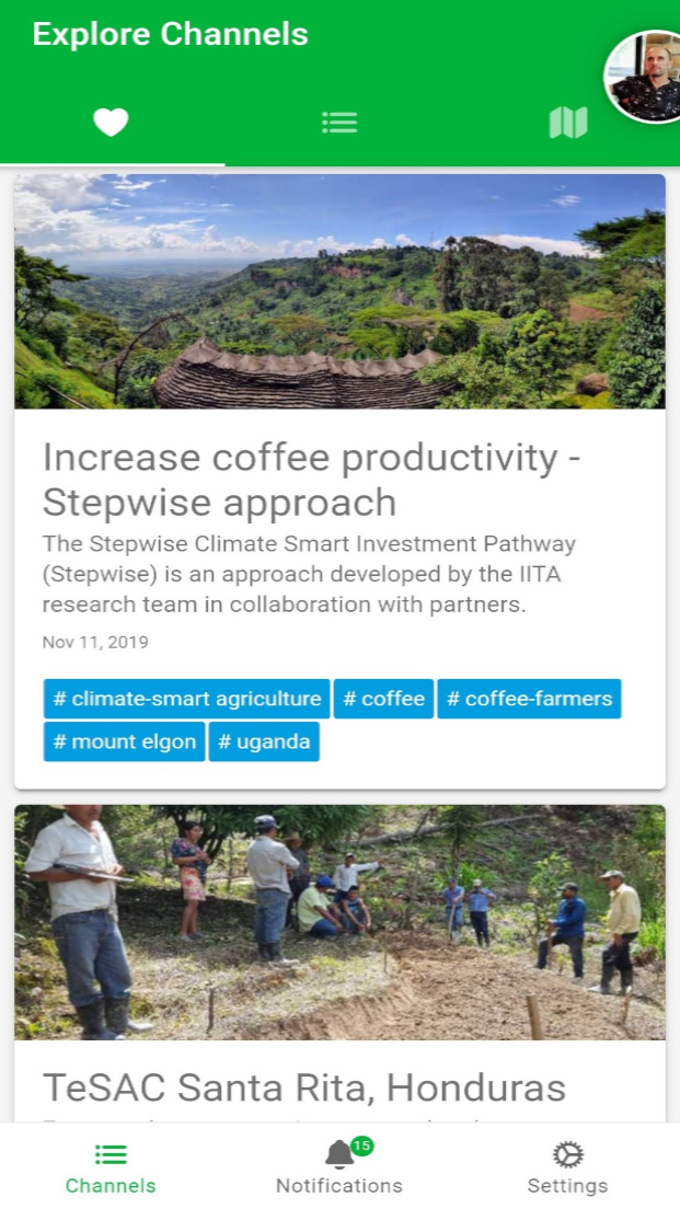
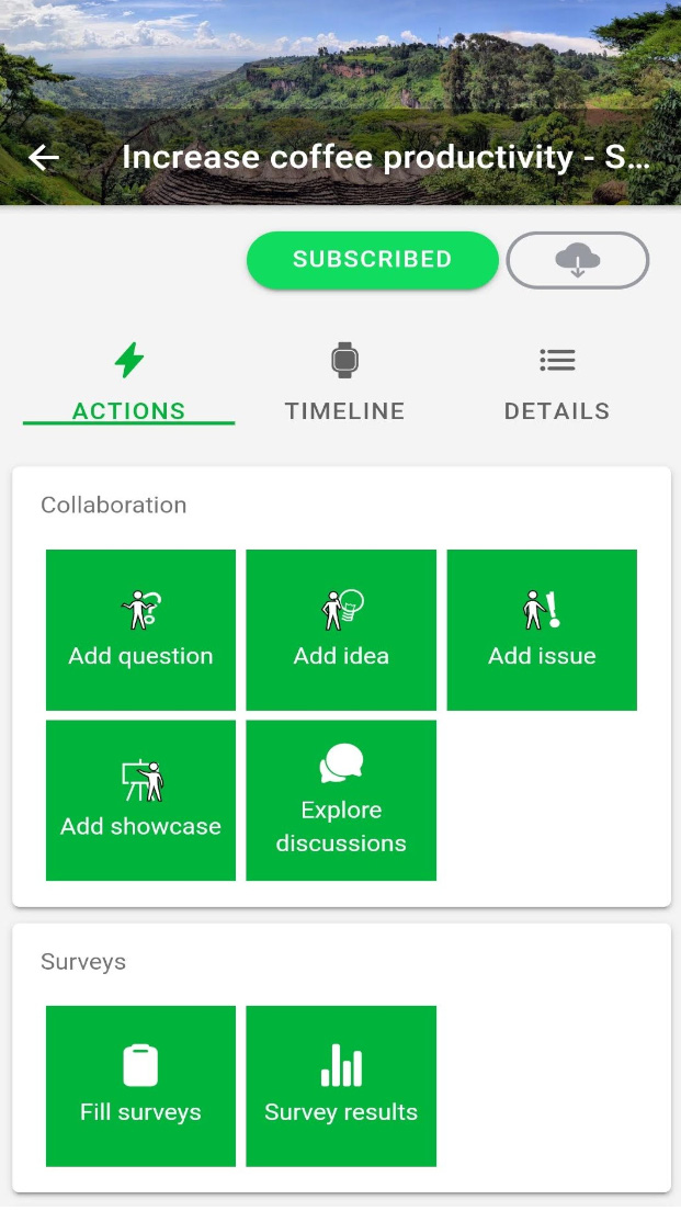
For agricultural development projects, GeoFarmer can facilitate two-way interaction and better follow-up with the farming community!
Watch the Instruction Video Now!

Check out what you can do with the GeoFarmer App!

GeoFarmer uses channels to provide a project-like structure!
In a Geo-Farmer channel, a user can have four distinct roles: a moderator, a facilitator, a geo-data manager, or a user!
Collect data and run surveys, ask questions and share knowledge!
GeoFarmer is modular in structure, with specific modules available to channels!
| GeoFarmer App: A tool to complement extension services and foster active farmers participation and knowledge exchange | Info note - CGSpace | Download |
| GeoFarmer: A monitoring and feedback system for agricultural development projects | Scientific paper - Computers and Electronics in Agriculture | Download |
| Monitor climate-smart agricultural interventions with a real-time participatory tool | Project Report - CGSpace | Download |
| A Multi-National Human–Computer Interaction Evaluation of the Public Participatory GIS GeoCitizen | Scientific paper - GI_Forum 2019 | Download |
| Status of CSA adoption and related impact on farming communities across 8 CSV implementing the CSV monitoring plan in 2018 | Status Report - CGSpace | Download |
| The GeoCitizen-approach: community-based spatial planning – an Ecuadorian case study | Scientific paper - Cartography and Geographic Information Science | Download |
| Using Science Knowledge and Expert Feedback to Accelerate Local Adoption: Climate Smart Technologies and Practices Meet ICT Tools | Project Report - Researchgate | Download |